Sacred Sites on the Beara Peninsula

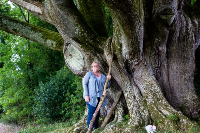
I spent several days wandering the narrow lanes of the Beara in search of ancient sacred places. While I had an idea of some places I wanted to visit, I also discovered some unexpected treasures in my meanderings. The Irish people have done an excellent job of preserving many of their historical treasures, and periodically, you’ll come across a brown street sign identifying some of these places that aren’t even on regular maps.

20150825-StoneCircle-2015005

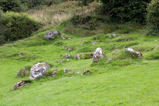
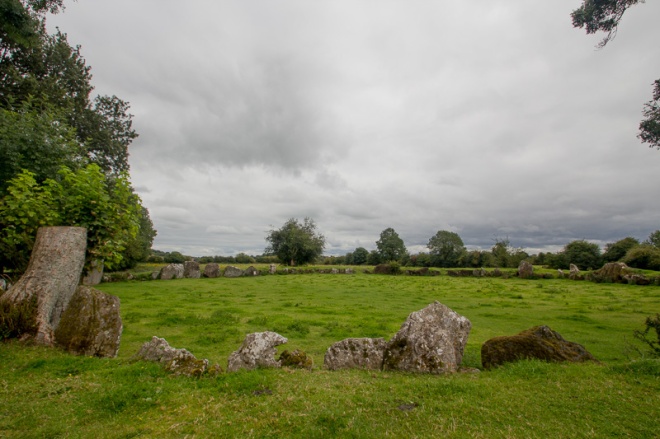
Just a few km northwest of Castletownbere is a beautiful standing stone circle at Derreentaggart West. It is in the middle of an accessible field, and the day I visited, the area around the circle had been recently mowed and was quite mucky. The stones here are large and while some have fallen, the circle is generally intact. 20150825-StoneCircle-201501620150825-StoneCircle-2015019

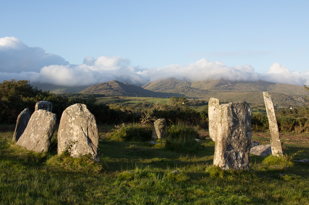
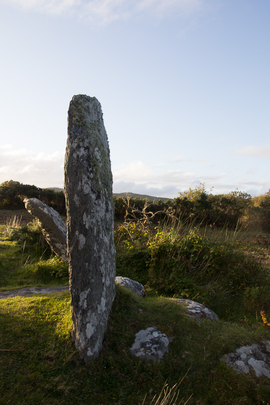
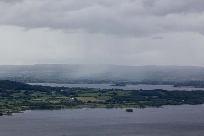
From this location, you could see the lighthouse on Bere Island to the south, and the Miskish Mountains to the east.

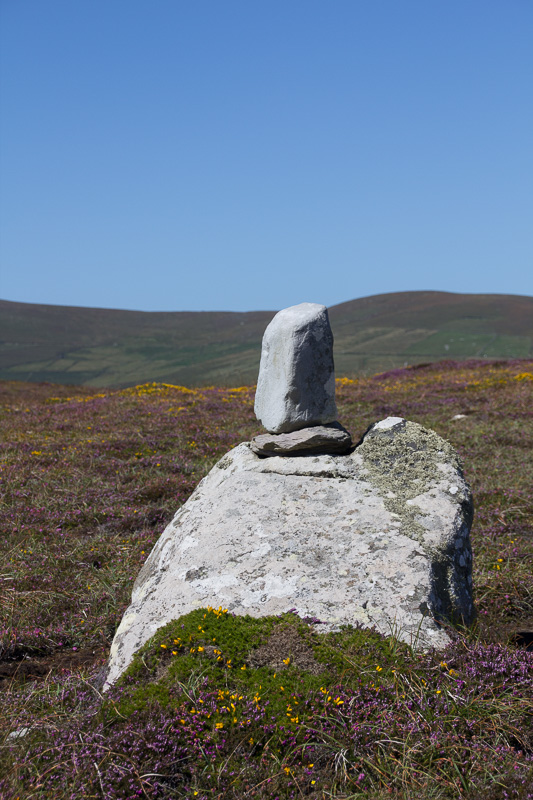
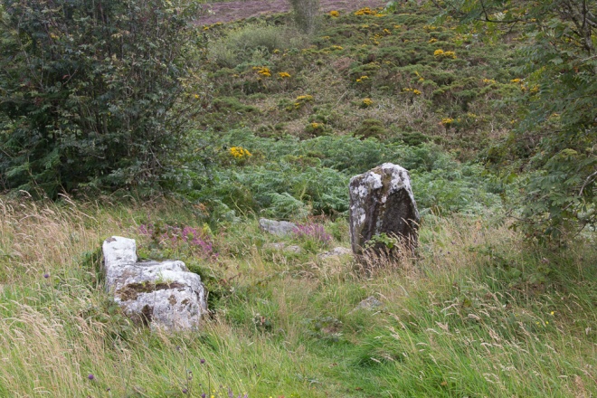
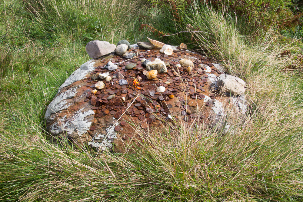
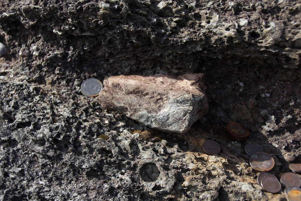
Driving from Castletownbere, as I approached the colorful village of Allihies, I saw another brown sign, this one for “Children of Lir Grave.” Knowing the myth, I drove a short distance up the road to the site. 20150826-RingofBeara-2015042
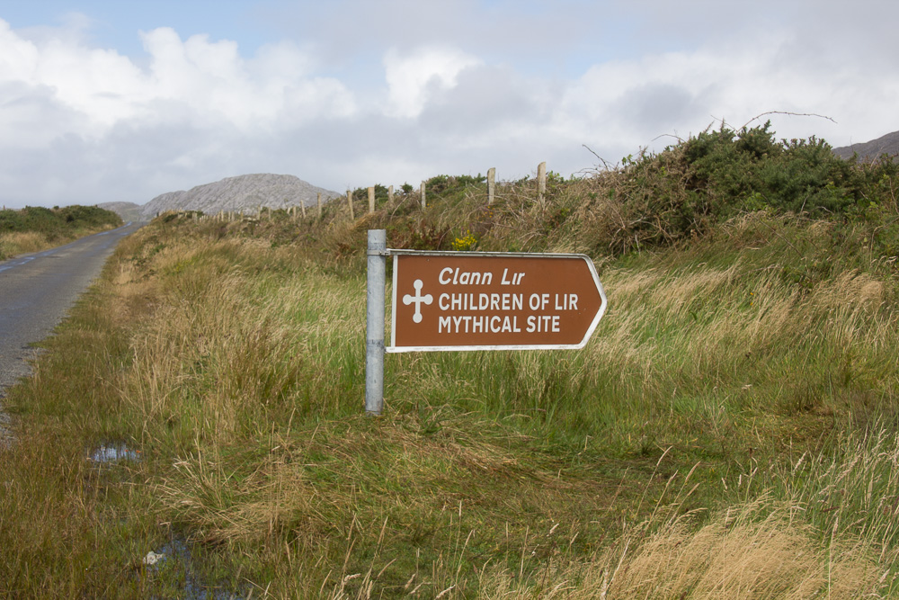
The legend about the Children of Lir is that after their mother died, the children’s father, Lir, married his wife’s sister. She became extremely jealous of Lir’s devotion to his children so she turned them into swans, for nine centuries. After 900 years passed, the swans flew to Allihies, where they were returned to their human form, but they were quite old and died almost immediately. The legend is that they are buried here, under large white rocks. All that remains is a single rock, and on it, offerings were left to the children.

20150826-RingofBeara-201504320150826-RingofBeara-2015046

I stopped at a little café and museum in Allihies, the Copper Café, and discovered it also housed a lovely little art gallery. While not an antiquity, I had to show what a beautiful exhibition space it is (for my photographer friends)! AllihiesGallery

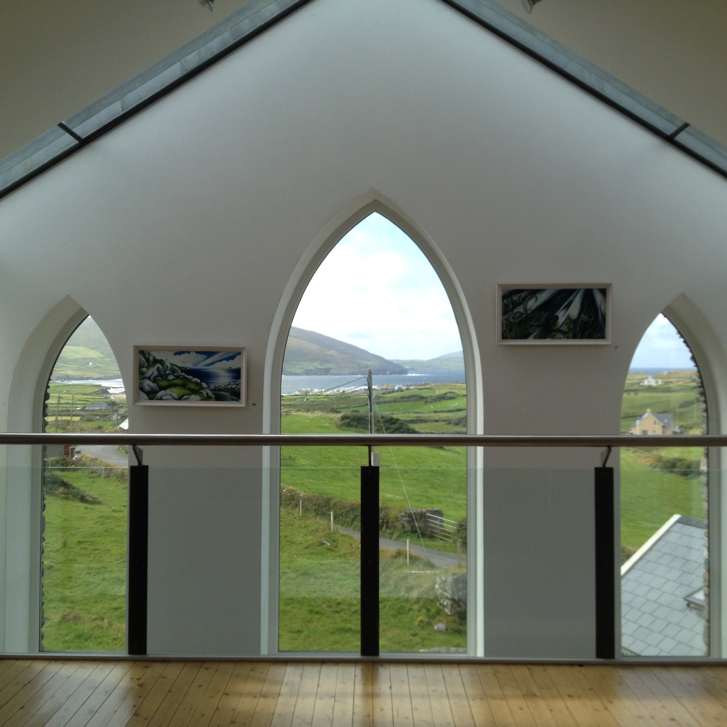
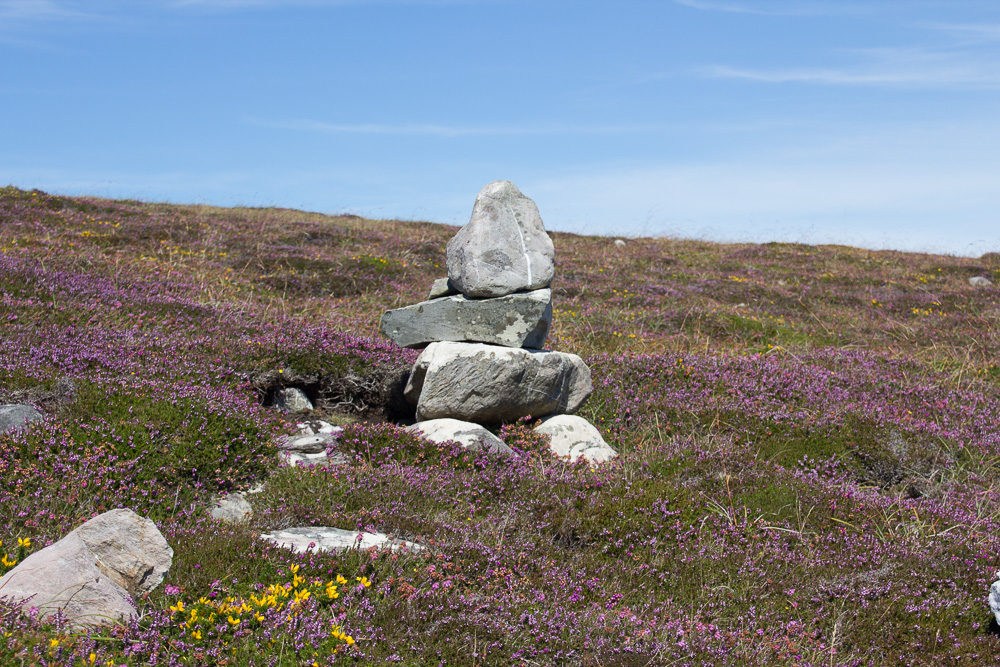
On the road from Allihies to Eyeries, I unexpectedly came upon a mass rock. During the Penal Times in the early 18th century, religious persecution of Catholics was rampant, and assembling and practicing one’s faith was dangerous. (For a quick summary, click here to read more about the Penal Laws.)

20150826-RingofBeara-2015073

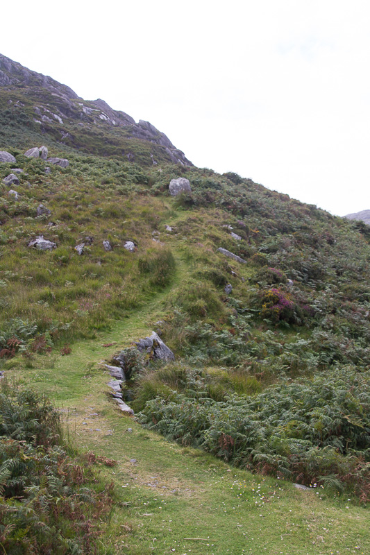
Beginning of the path to the distant Mass Rock.

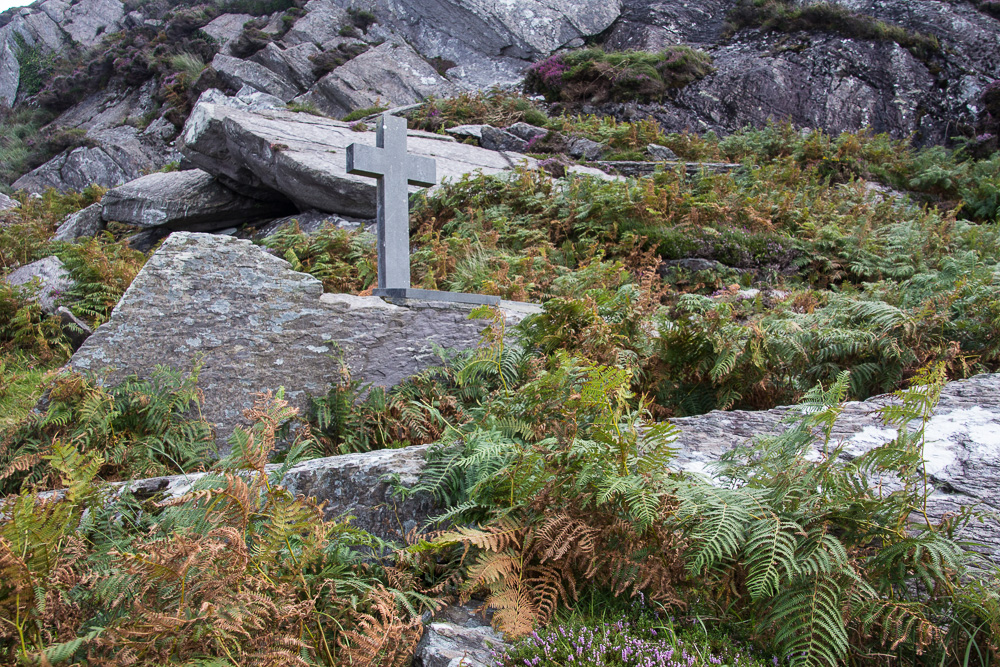
As a result, parishioners would assemble in obscure locations to observe mass, where large flat rocks served as altars, sometimes marked by a simple cross. Driving through the mountains, I came upon a roadside marker for Carraig an Aifrinn or Mass Rock. It was a little bit of a hike up the mountain on a rock and mud path, and as I walked I thought of the people who had traversed this same path over 200 years ago, simply to practice their religion.

20150826-RingofBeara-2015080
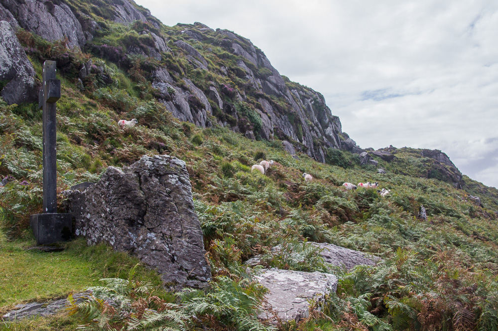
I climbed the hill and sent some sheep scampering upward. The site was lovely, overlooking the ocean, with the rocky mount behind. Someone had erected a large cross at the site, which would not have been there during the time the mass rock was in use. I reflected on how fortunate I am to freely practice any religion or have any kind of personal beliefs, without fear. I said a prayer for all those, both then and now in the world, who do not have such freedom.

20150826-RingofBeara-2015083

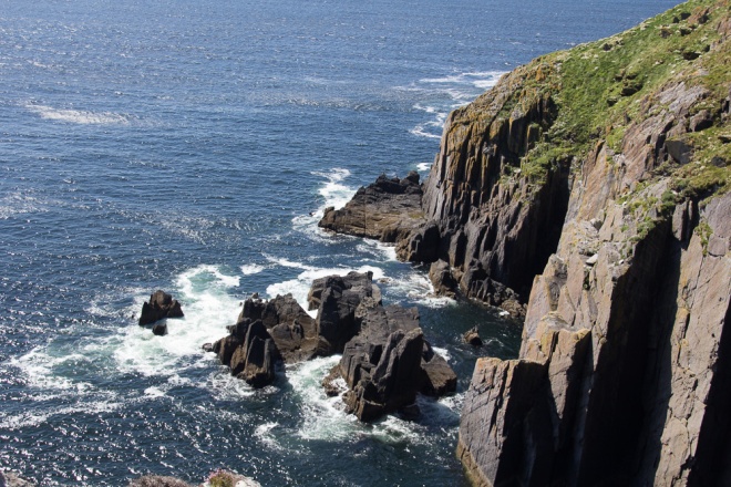
North of another colorful village, Eyeries on the northern coast of the Beara Peninsula, is an area with three interesting megalithic sites. I am grateful to the woman at the Eyeries Post Office for telling me how to find these locations on the way to Kilcatherine Point. The first of these is a large Ogham Stone located near Faunkill and the Woods, believed to be the tallest ogham-inscribed stone in Ireland. Ogham is an ancient writing system, sometimes known as the Celtic Tree Alphabet. Click here for more information. This ogham stone is on private property and I could not get close to see it, but even from the harbor at Coulaugh Bay, it was impressive. 20150826-RingofBeara-2015099

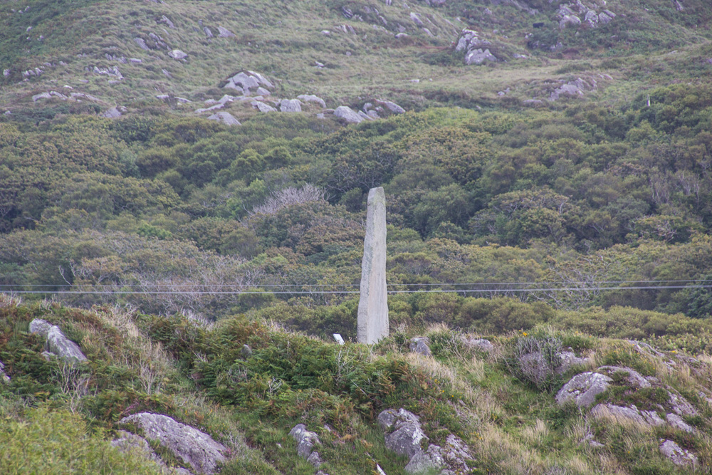
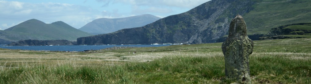
Driving along the narrow road to Kilcatherine, I found An Cailleach Bhéara, the Hag of Beara. 20150826-RingofBeara-2015124 20150826-RingofBeara-2015116 20150826-RingofBeara-201511220150826-RingofBeara-2015108

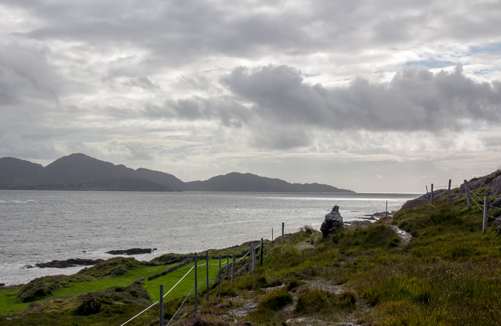
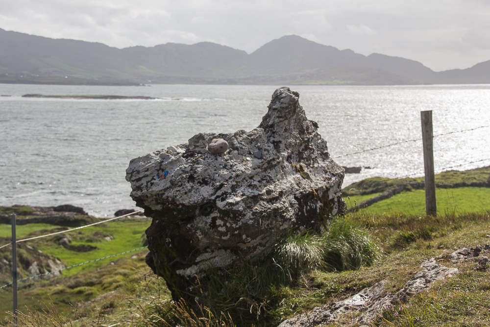
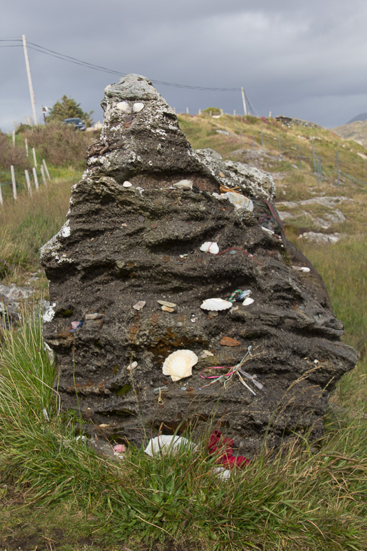
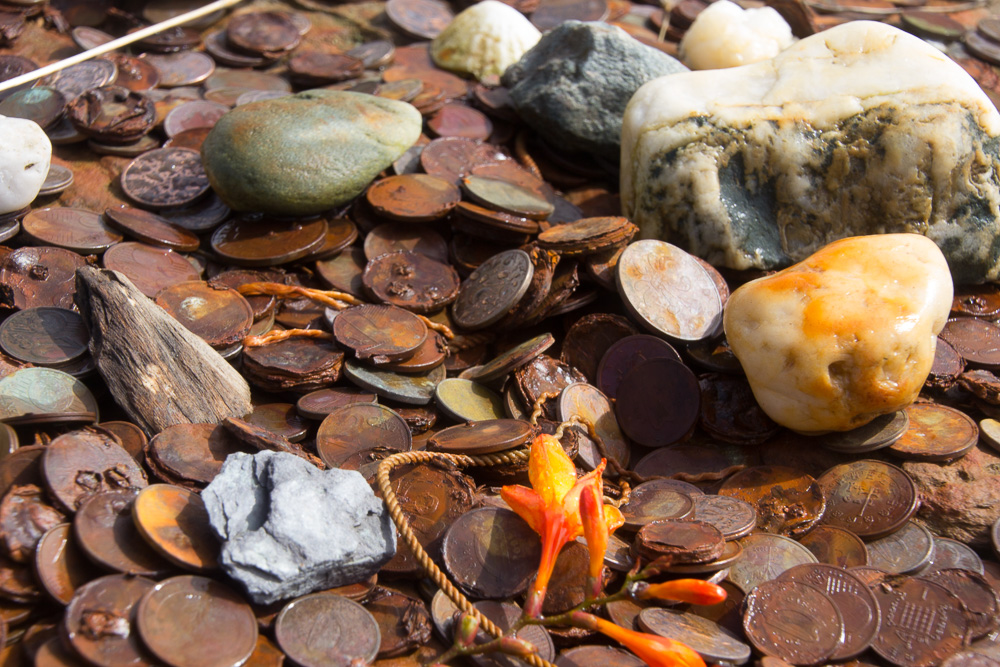
There are many legends about the Hag, including that she was Mother Earth and Protector of the Land. Most of the legends indicate that she was a powerful woman who chose to turn herself into the rock so there would always be a hag to keep watch. I made my way down to the overlook and there she was, facing the sea. Now I don’t recognize her shape as a hag, but who am I to argue? Again, people had left offerings here for An Cailleach: coins, notes, seashells, fishhooks, earrings, scarves, even a screw. I had brought nothing, but I searched and found an interesting rock, and with my best intentions, I left it for her.

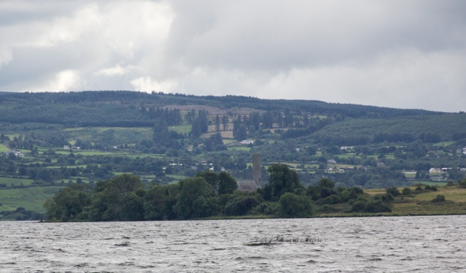
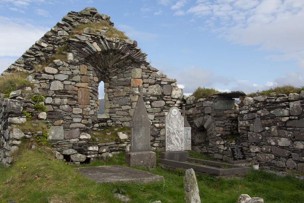
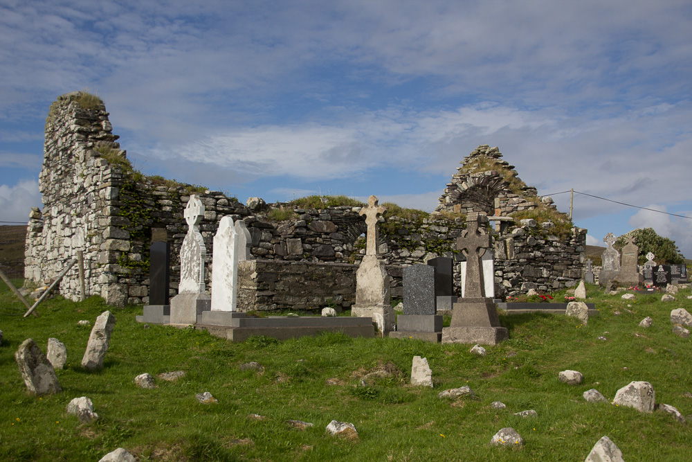
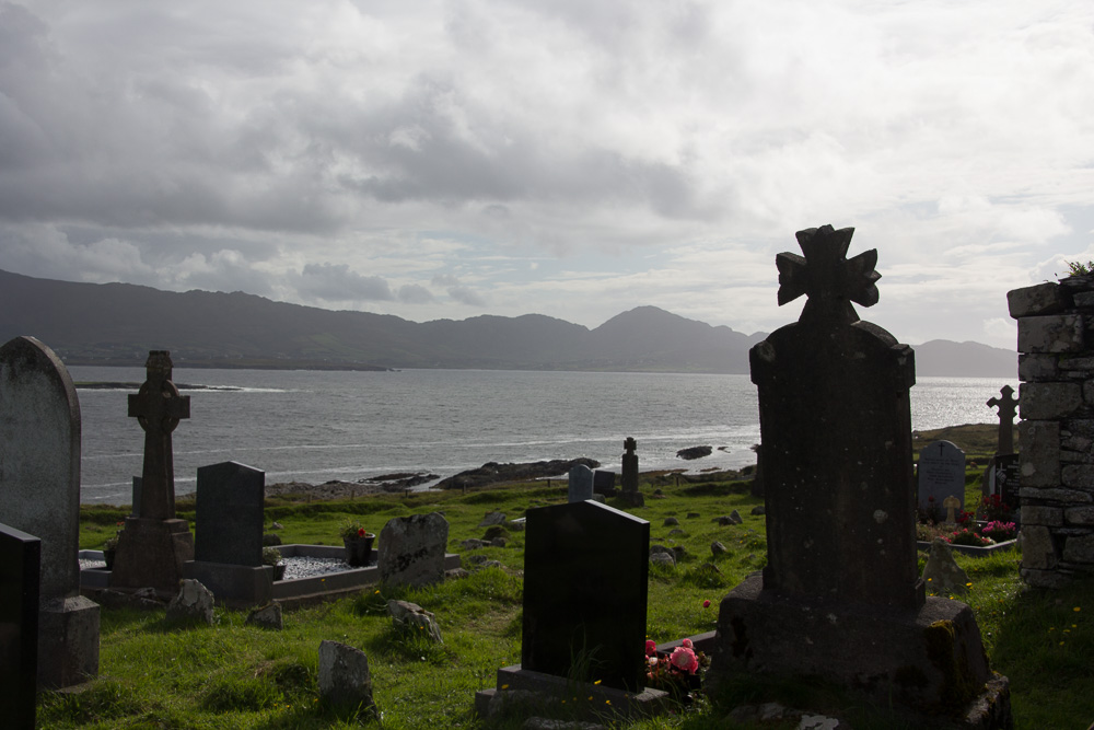
From here, it was just a short distance to the old graveyard and stone church at Kilcatherine. This was a hauntingly beautiful location and I spent quite a bit of time walking among the graves and stones. There are some recent memorials, but many of the graves are marked by simple rocks, now covered over with grass. I generally find graveyards to be serene and peaceful. Here, as at all of the sites I’ve mentioned in this posting, I was alone, in complete solitude. There are many places where one can be still on the Beara Peninsula.

20150826-RingofBeara-2015129 20150826-RingofBeara-2015142

20150826-RingofBeara-2015135

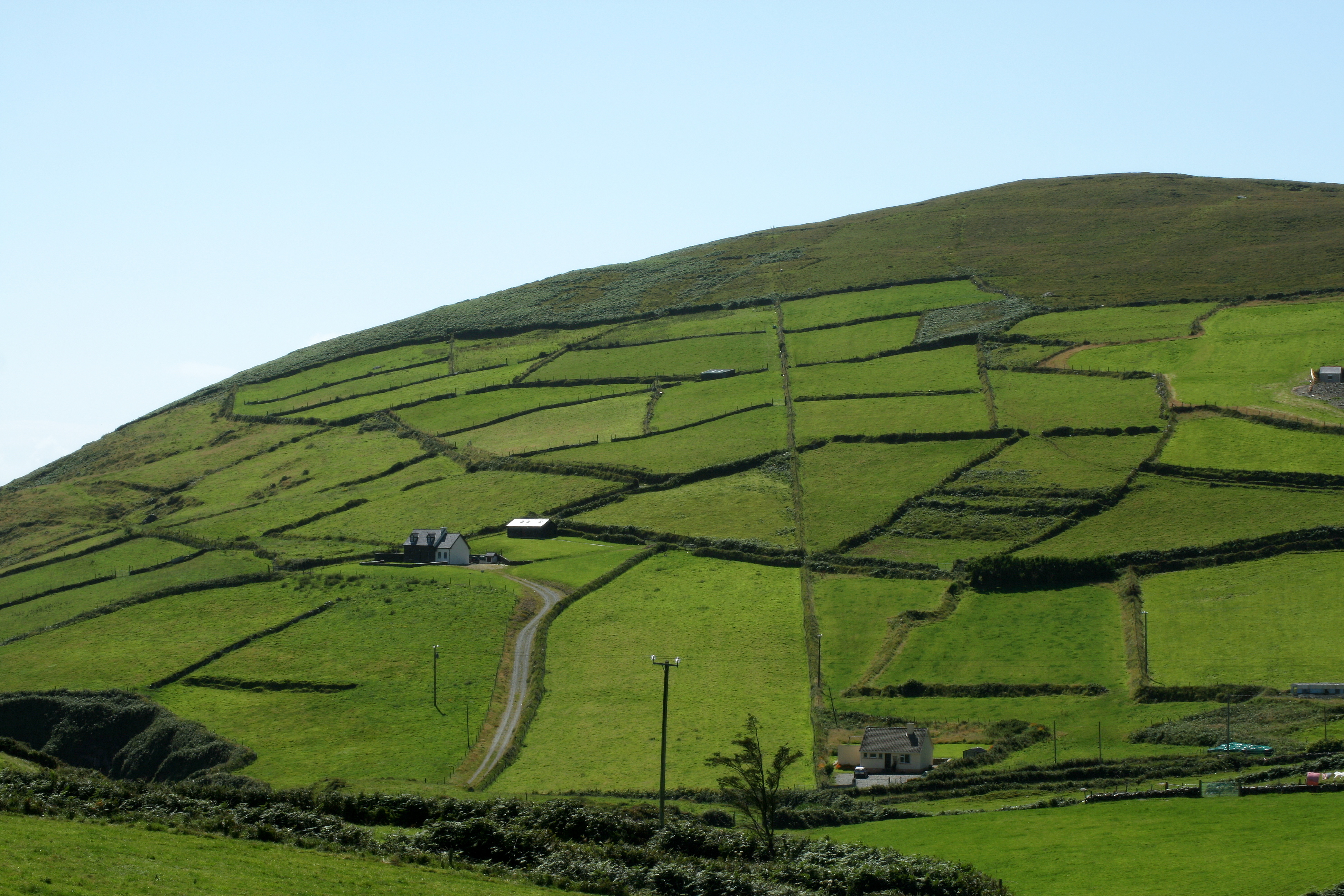
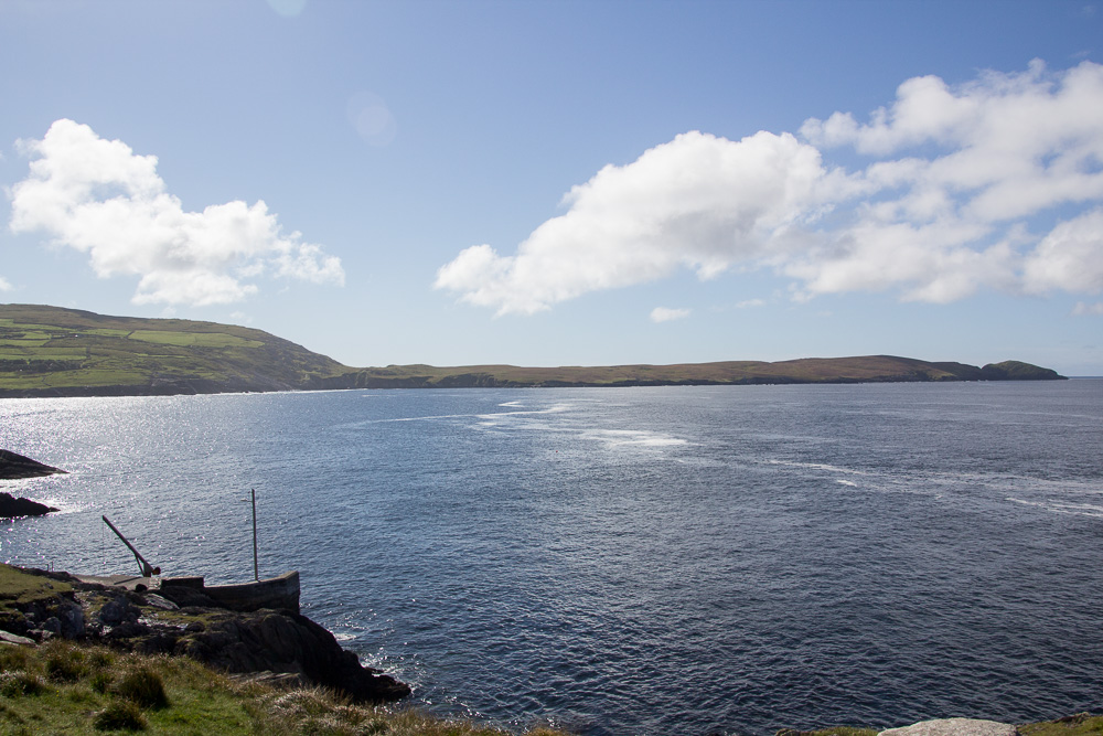
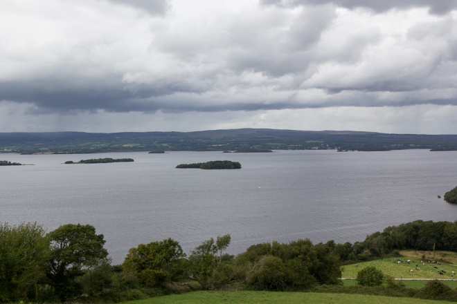
Finally, I am including photos of a beautiful, though not ancient, place called the Dzogchen Beara Meditation Retreat Center, http://dzogchenbeara.org/ located high on a hill overlooking the ocean towards the Sheep Head Peninsula. I had originally learned of this place when my husband was ill. They offer different retreats, both for people dealing with terminal illness and for those who are bereaved, and also have a hostel, café, and other facilities open to the public. The scenery is amazing, and the meditation room has an unobstructed view of the ocean.  20150825-BuddhistCenter-2015033

While I had never participated in a group meditation before, I attended and found it a peaceful, meaningful experience. The 45 minute guided meditation is offered daily, year round, and consists of 5-10 minutes of resting and settling one’s mind, followed by a 25-30 minute practice of Loving Kindness. The meditation is simply quiet, focused prayer, for oneself and for others, sending love and healing to the world.  MeditationRoom

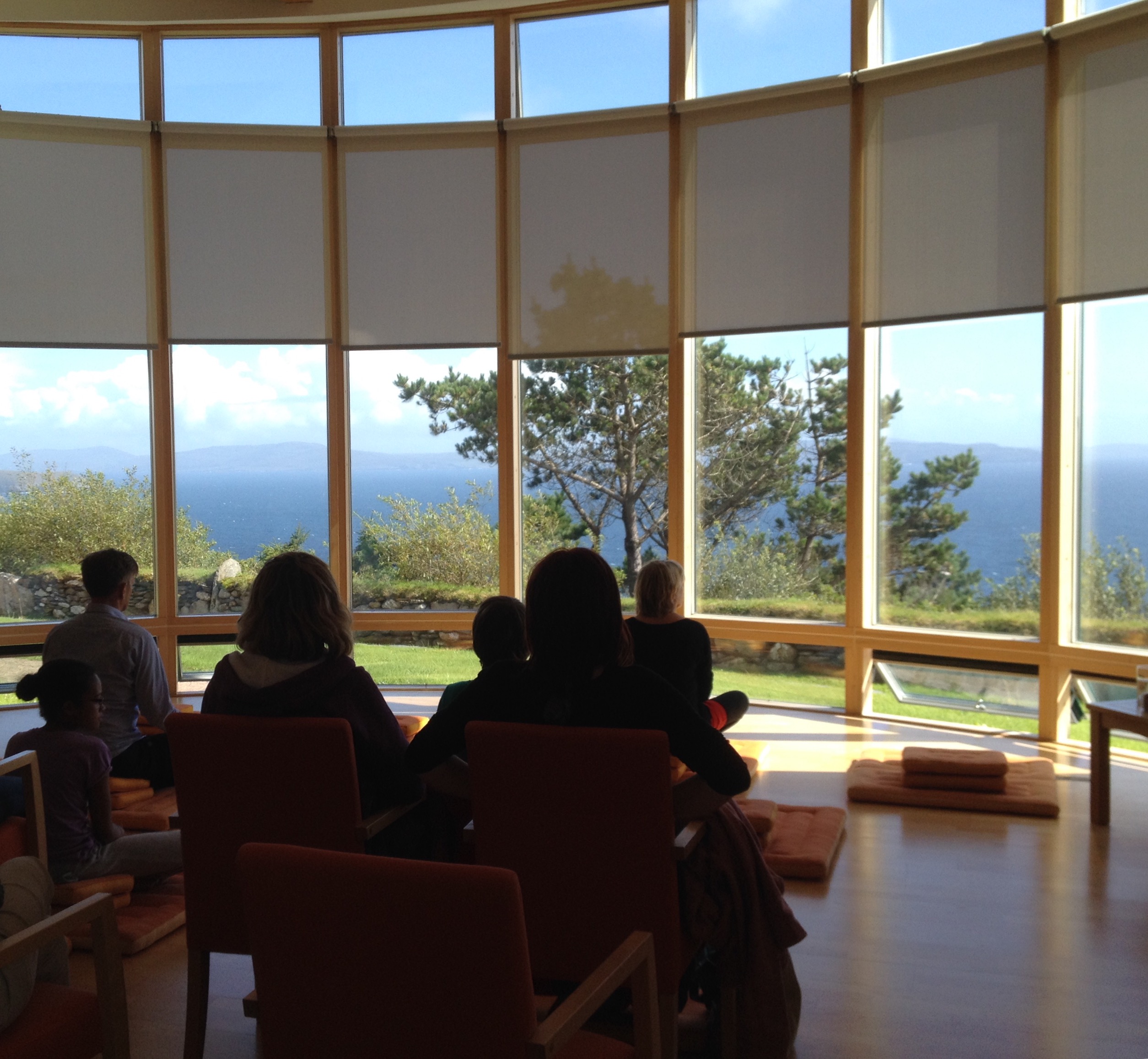
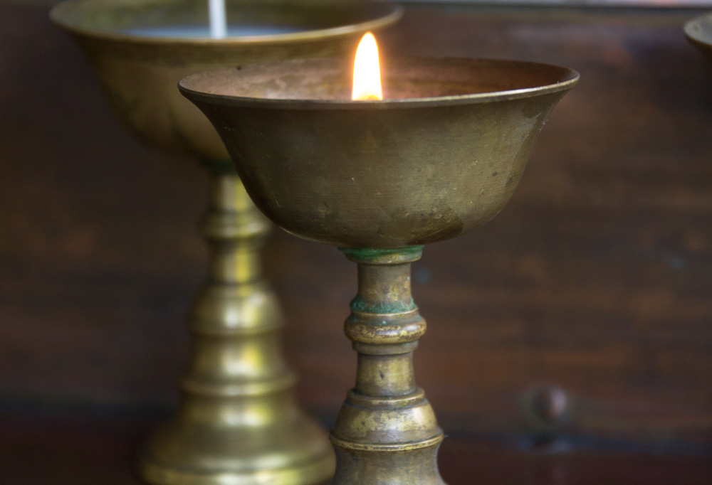
Before I left Dzogchen Beara, I lit candles, for my late husband and loved ones. This practice of remembering, embracing, and celebrating their lives, in this special place of quiet and calm, will always be in my heart. Thank you, Beara Peninsula, for your quiet, thin places.

 20150825-BuddhistCenter-2015026

Crow Head on the Beara Peninsula

IMG_2122The Beara Peninsula, in the far southwestern corner of Ireland is AMAZING! The landscape is absolutely spectacular and because the roads are incredibly narrow, there are no tour buses and very few campers, or caravans, as they are called here. The Beara is only 30 miles (48 km) long, but driving the Ring of Beara from Glengarriff in Cork to Kenmare in Kerry, is roughly 98 km. There are two mountain ranges, Slieve Miskish and the Caha Mountains. Castletownbere is the largest white fishing port in Ireland. Click here for a map of the area and the Ring of Beara driving route.

CHeadfromDursey

Crow Head looking south from Dursey Sound

Dursey

Ireland’s only cable car, view from the mainland to Dursey Island.

I met a new friend, Sabine, from Germany at my B&B, and we hiked an area known as Crow Head, located at the very western tip, across from Dursey Island and its famous cable car (which I did not ride!). The Crow Head walk was about 3 miles from where I parked my car to the end and we passed both open meadows and sea cliffs, and a few sheep. We were the only people the entire time we were there, and I’ve never experienced such quiet. The only sound was the wind whipping through the grass and flowers, save a few gulls, and one lone crow who flew overhead on our way back. This little peninsula is known to be a good spot to see dolphins and whales, but the water was too choppy and we didn’t see any.

20150823-Beara-2015039

The gorse was thick carpet underfoot, almost spongy, and the trail, little more than a sheep path, was sometimes difficult to walk. There wasn’t a single tree here; no shelter or shade. Near the middle of the small peninsula, on the northern side, I found two small cairns, conical piles of rock. I sat near one for quite a while, wondering who had built them and when. There are no loose boulders visible, as there often are in other parts of the Beara Peninsula, so it is a mystery as to how these came to be.

20150823-Beara-201504520150823-Beara-2015047

At the end of Crow Head, cliffs drop dramatically to the wild Atlantic, and directly across is another small island of black rock, topped with grass. It had been a difficult walk for a non-hiker and I was physically exhausted and looked for a place to rest. I finally found a small sheltered area, a cranny in the rock, overlooking the island. I withdrew in the stillness of this space as I rested and marveled at the raw power surrounding me: in the hard, jagged rock, the crashing waves, the gusty relentless wind – and realized I had found one of my thin places. A place I never would have come with my husband. A place I would not have known existed save for my host at the B&B. But I found it. I found peace and strength and courage here, at Crow Head, at the end of the wild Beara Peninsula.

IMG_0030

20150823-Beara-2015064

Land’s end, at the tip of Crow Head

The Lough Derg Way

Lough Derg in the Shannon River Valley is the third-largest freshwater lake in Ireland and in addition to hosting water sports such as boating and fishing, is surrounded by many holy sites. It spans three counties, Galway, Clare, and Tipperary. Over the last few days, while staying near Mountshannon, I’ve visited several sites.

Portumna

Portumna Laundry House

While not necessarily considered a thin place, I visited the Portumna Workhouse Centre in County Galway, and it is a deeply sorrowful place. One of 163 workhouses built in Ireland to deal with the “poverty problem,” Portumna’s Workhouse opened in 1852, after the worse years of the Great Famine. What was most disturbing to me was that entire families had to enter the workhouse together, in an attempt to clear the land of tenants, but once admitted, the families were segregated, with separate buildings for men, women, girls, and boys. Only children under the age of 2 were permitted to remain with their mothers, until they were also removed. Click here for more information about the Portumna Workhouse.

Portumna2

Women’s Building, Portumna Workhouse

BrianBoruTree3

An offering of oats and milk

Near the town of Tuamgraney in County Clare, I was taken to an ancient oak tree known as the Brian Boru Tree. Brian Boru, the first High King of Ireland, died in 1014 at the Battle of Clontarf, but he was from the town of Killaloe, about 20 km south of Tuamgraney. The ancient tree is not easily accessible, but it was worth the fence climb and hike through gorse and nettles. My host explained that when visiting the land of the ancestors, it is appropriate to make an offering to the land, usually of oats and milk. We made our offering and then simply spent time in this quiet place.

BrianBoruTree2

Brian Boru Tree

A strong northwesterly wind whipped the grasses in the adjoining field, but as I stood under the ancient oak, I knew that it would not be threatened. It had withstood the tribulations of a millennium, and it would continue to stand now. Despite winds, rains, storms, heat, and drought, the tree remained. And I realized that I too am resilient; despite the challenges and struggles, I, too, am grounded. I took strength from knowing the strength of this ancient tree. My roots indeed go deep.

BrianBoruTree

I wanted to visit Holy Island, about a mile from Mountshannon, but the weather did not cooperate. Perhaps on a future visit, I’ll be able to see the round tower and the monastic ruins, but for now, I could only view it from the harbor. Holy Island’s mysteries will remain unknown.

HolyIsland

Holy Island, from Mountshannon Harbor

Killaloe

Killaloe, County Clare, from Ballina

Near the southern end of Lough Derg are the twin towns of Killaloe in County Clare, and across the Shannon River, Ballina in County Tipperary. These lovely little towns are quintessential Ireland, complete with incredibly narrow roads and colorful buildings. I drove north from Ballina on the R494, up the mountain towards the town of Portroe.

LoughDerg2

Lough Derg from North Tipp

There were mesmerizing views of Lough Derg and the stillness was nearly deafening in its own way. Continuing on the Lough Derg Way, I found the Graves of the Leinstermen, a group killed by Brian Boru’s Munstermen in 999 . The looped trail takes 3-4 hours, and there is a convenient pull off near the trailhead.

LoughDergRain

Rain over Lough Derg, view from North Tipp

The Lough Derg area is steeped in history and has many more thin places, waiting to be discovered, whether by guide (thank you, Rob!) or by oneself. The clearest message I took away from this area was to not be afraid and to trust that what I seek, I will find.

Leinstermen

Graves of the Leinstermen, Tountinna, Co Tipp

MtFlower

Wildflowers at the Graves of the Leinstermen

On the Road

LoughGur-2015004

Lough Gur Heritage Center

After a good night’s sleep, I picked up my car in Limerick and hit the road. My first destination, Lough Gur, was about 20 km south. Lough Gur is a megalithic site dating to 4,000 BC. Ancient dwellings, both round and rectangular, have been uncovered, and the Heritage Center is designed after these dwellings. The area was buzzing with activity as schoolchildren are still on holiday here, but I was the only one at the dwelling site.

LoughGur-2015006

Just 5 km away, is the Grange Stone Circle, the largest standing stone circle in Ireland, comprised of 113 stones and over 150 feet in diameter. Located right off the highway, the stone circle sits in a farmer’s field. As I walked up the embankment to the circle, a herd of perhaps 15 cattle came running, literally running, up to the fence. I don’t know if they were coming to greet me or warn me away. I began walking counter-clockwise around the perimeter and came upon four cows lying at the edge of embankment, on the opposite side of the fence. I didn’t question them, nor they me, and we managed just fine.

LoughGur-2015035

Grange Stone Circle

The Grange Stone Circle is an amazing site, and I could feel an energy as I passed among the stones, into the center. I can’t describe the feeling, nor explain what I felt, but it was a magical place. While I was there, a man came into the circle and after taking some pictures, he produced a large drum, possible a bodhran, and walked the stone circle, drumming. I was honored to have been present, in this place of our ancestors… and cows.