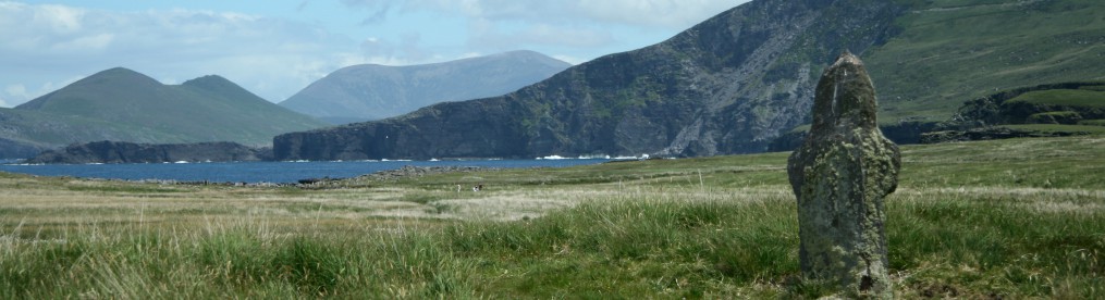
Of the four regions of Ireland, Connaught is probably the most rugged. Stretching along the west of Ireland, the landscape of Counties Mayo and Galway, alternately mountainous and boggy, is frequently shrouded in a deep mist which the sun does not easily pierce. But when it does, the sky is a brilliant blue and the land has a golden hue.
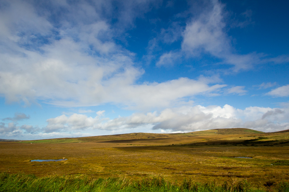
The bogs stretch for miles and little of substance grows here. With increasing pressure from the EU, turf or peat harvesting is in substantial decline, and the bogs are continuing their centuries-old cycle of growth and decay, growth and decay. Sheep graze on the mountains and hills, but there are few cattle. Fishing the Atlantic waters continues and is a dangerous occupation. The week I was here, searches were ongoing for a local man who was missing at sea. As one man in a pub told me, “the sea is a harsh mistress.”

Some describe the area of Erris and the Belmullet Peninsula in northern Mayo as the “last frontier,” and it appears to be so. While Donegal to the north is also rugged with mountains, this area is different. The wind blows constantly across the treeless bogs and rocky outcroppings. Even in September, the gales from the Atlantic are relentless. It takes strong people, familiar with the land and sea, to live here. This is an area of the Gaeltacht, where all of the road signage is in Irish and outsiders are noticed. It is a place where the intensity of nature has taken its toll on the land and its inhabitants. It is Mayo.
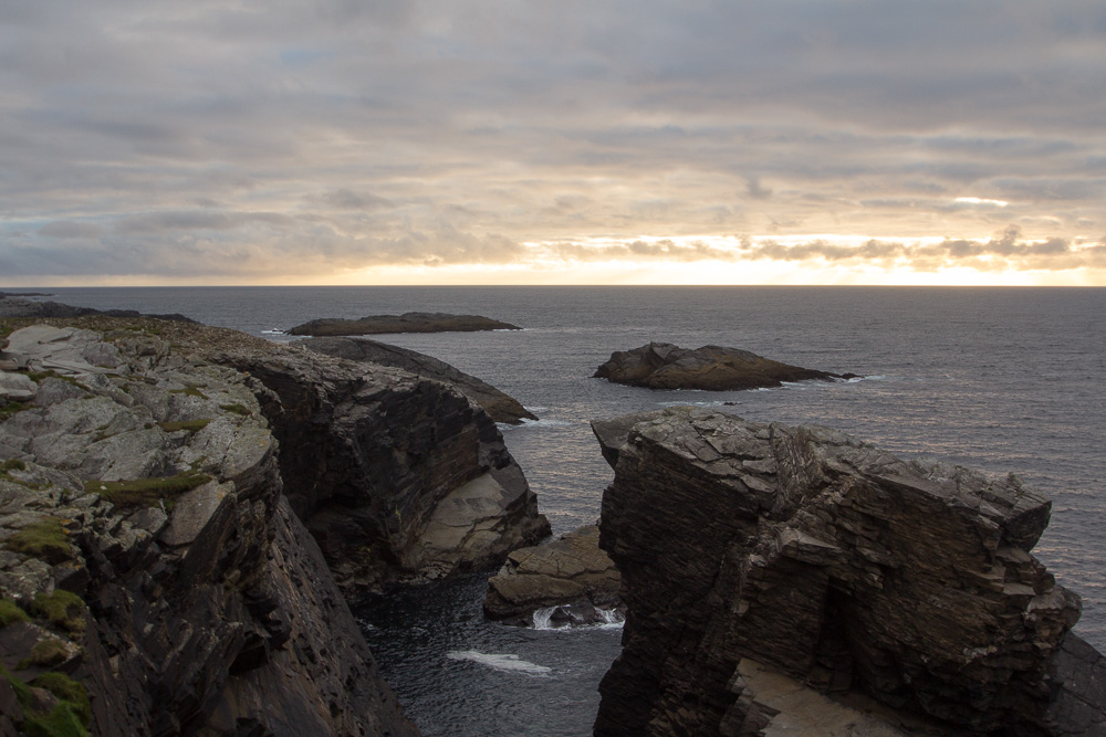
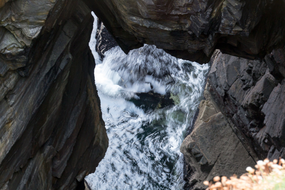
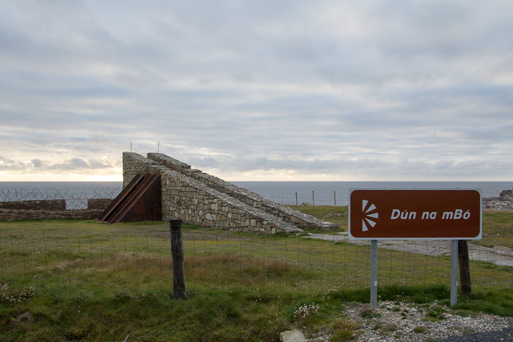 West of Belmullet, on a coastal road, is Dun na mBo, Fort of the Cow. This iron and stone structure stands silent watch over the ocean below, and entering between the slanted columns and protected by a strong gate, I see the maelstrom. Dun na mBo jarringly reminds you that you are a guest of nature here. You learn to respect and fear the sea or she will consume you.

 Blacksod and her stalwart lighthouse are at the end of the Belmullet Peninsula. On the day I drove to her, fog and rain surrounded Blacksod, and I didn’t venture far from my car. I wished the weather had been more accommodating, as I wanted more suitable photos of the sculpture in the shape of a boat near the pier. Each pillar symbolizes a different ship that emigrants boarded leaving from Blacksod, and on each stone is a plaque bearing the known names of those who departed. The website, http://www.blacksodbayemigration.ie/ explains the memorial:
“A memorial garden has been created in Blacksod by Comharchumann Forbartha Ionad Deirbhile Eachléim in 2013 marking the 130th anniversary of the first sailing. The orientation of the boat is due west indicating the direction of the emigrants’ journey across the Atlantic. The side of the boat is divided into fifteen sections, each representing a ship that left Blacksod Bay. The width of each section relates to the number of passengers who left on each ship and their names are displayed. The sections are separated by spaces of varying sizes representing a timeline of their departures.”

Blacksod is a place of emigration. It is a place of memory.
As I left Erris, I drove along Broadhaven Bay before heading south for towns with names like Ballycroy and Mallaranny. I will let the photos speak for themselves.


Pingback: County Mayo RevisitedTour | Journey to the Thin Places