County Mayo Revisited

20151002-FinnyMaskBtubber-2015018

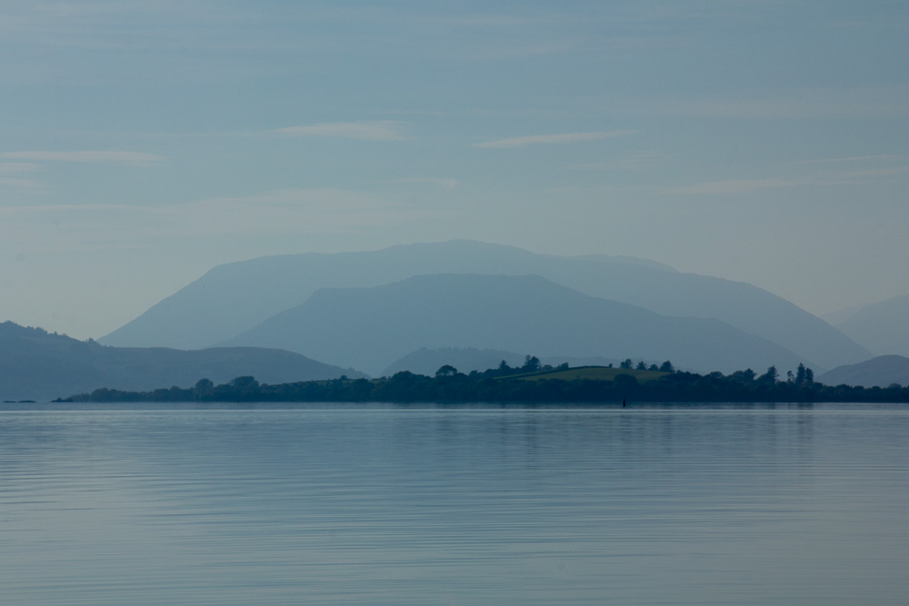
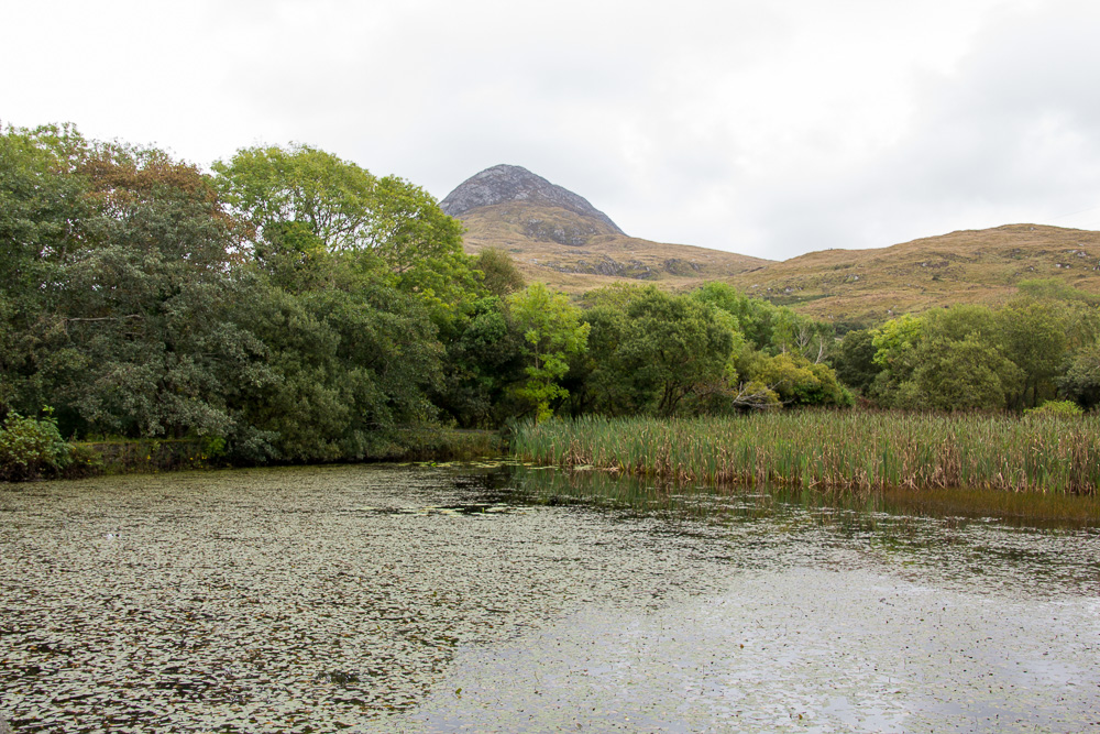
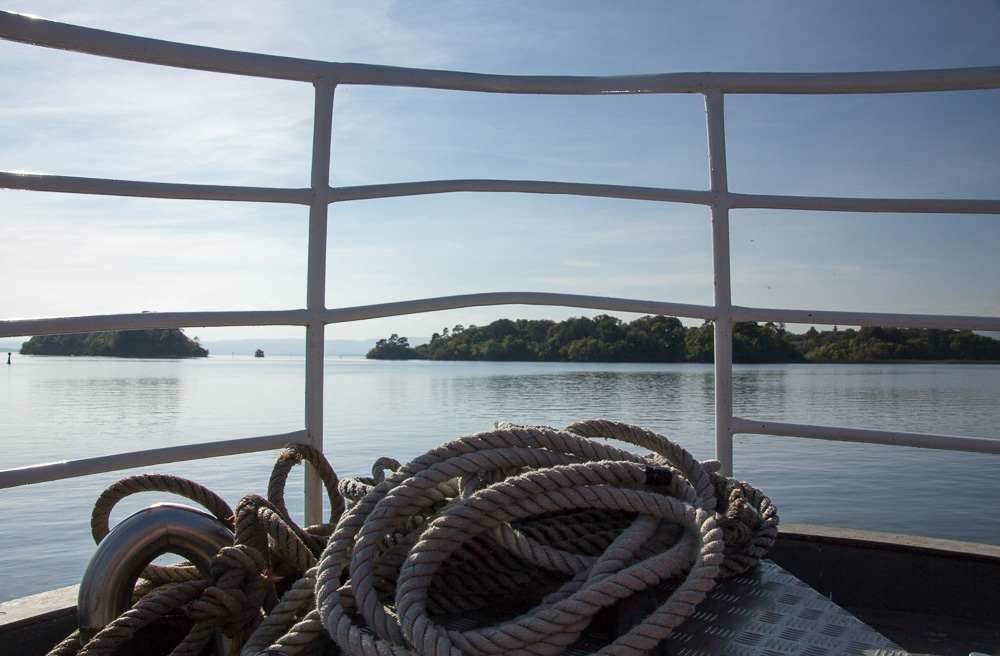
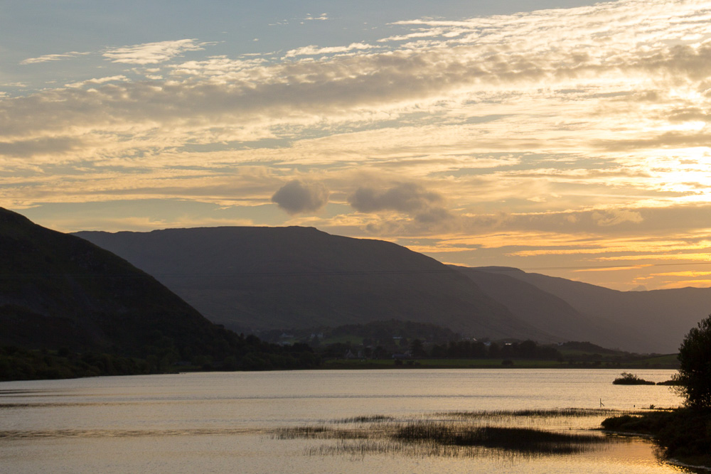
Lough Nafooey from Finny, County Mayo

IMG_6000B

Doolough Pass, County Mayo

I returned to County Mayo and arrived in the coastal community of Westport during the Westport Arts Festival. Once again, I was treated to music, dance, exhibitions, artist talks, and film.

20151003-Westport03Oct-2015023

Sean Nós Dancing during the Westport Arts Festival

20151003-Westport03Oct-2015044

The film, Draíocht Mhaigh Eo (The Magic of Mayo) is a compilation of archival film footage from the Irish Film Institute about County Mayo from the last hundred years, with music composed specifically for the film that was performed live. Click here for more information about this wonderful film. You may also view a rather graphic clip from the film called “Whaling Afloat and Ashore” that was filmed in 1908 that is available on youtube. As the gentleman beside me in the film screening whispered, “at least it’s not in color.”

20151008-Westport-2015053
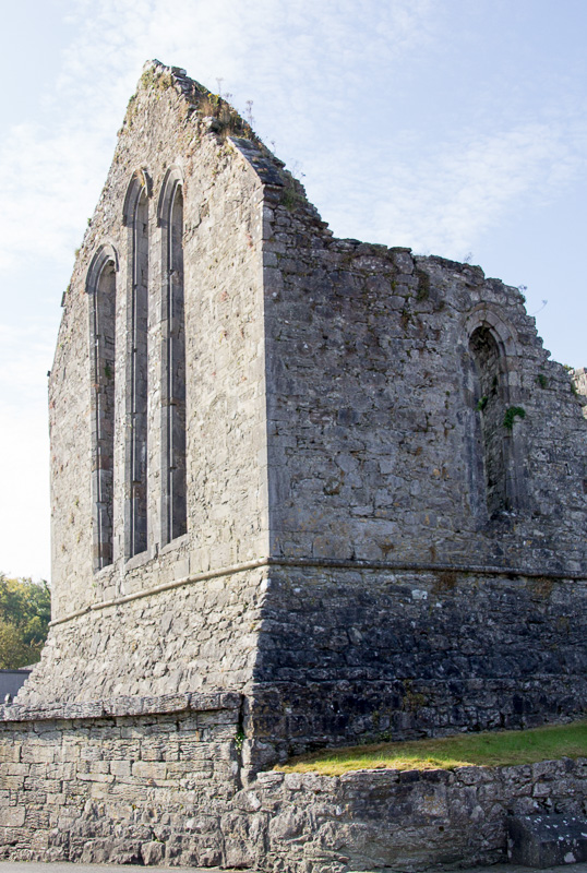
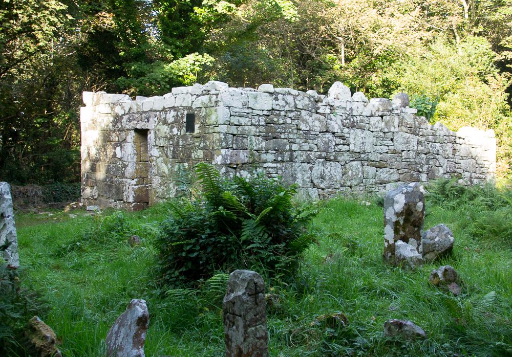
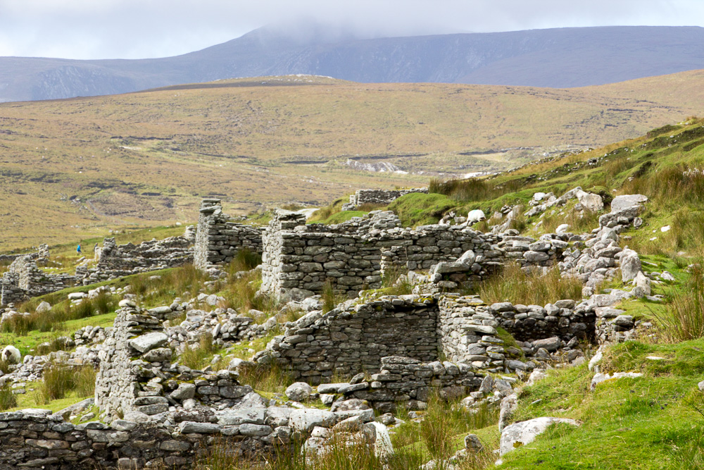
Near Newport on the road to Achill Island, lie two historical sites dating from the 16th century. The first, Burrishoole Abbey, was built by monks and overlooks a tidal estuary. The abbey and graveyard are easily accessible and this beautiful, quiet location lets one wander and be lost in thought. One poignant gravestone touched my heart, that of a woman whose husband had preceded her in death by 41 years. How lonely she must have been until she died in 1965. 20151008-Westport-2015065

Just a few miles from here is Rockfleet Castle, also known as Carrickahowley Castle, a tower castle of the O’Malley clan and believed to be where Granuaile, or Grace O’Malley, died.

20151008-Westport-2015080

Rockfleet or Carrickahowley Castle, Co Mayo

20151006-Westport-2015007

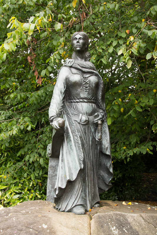
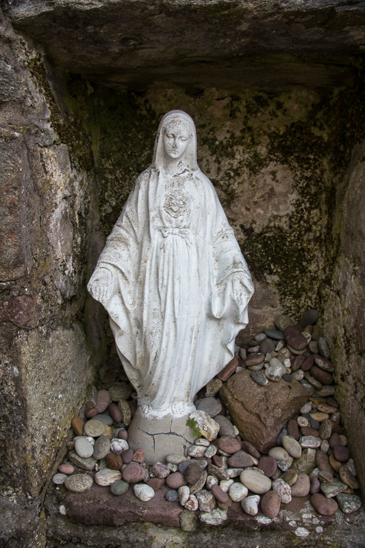
Granuaile, Grace O’Malley, the Pirate Queen

Granuaile, the Pirate Queen, was an impressive, powerful woman who has been erased from much of written Irish history, but who is infamous in County Mayo. Legend purports that Westport House, located in the town of the same name, was constructed on top of Granuaile’s former castle dungeons and her family’s descendants still own the house. For more information about Ireland’s Pirate Queen, read this fascinating account by author Anne Chambers. Granuaile is very much a presence throughout the west of Ireland.

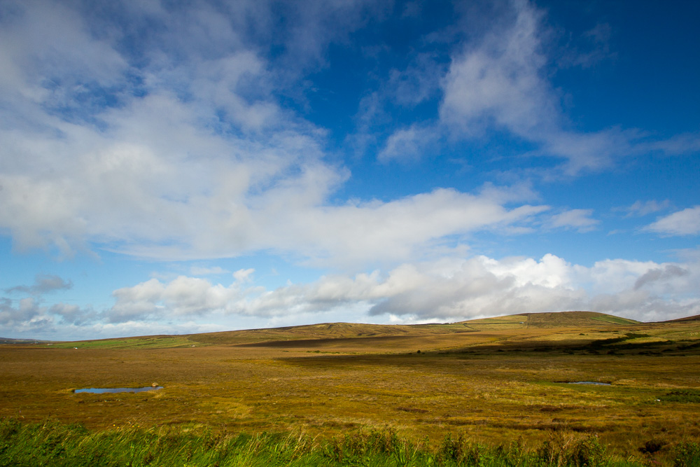
County Mayo has many thin places (see also Wild, Wild Erris). Croagh Patrick is located in Murrisk, five miles from Westport. While not the highest peak in Ireland at 2500 feet, it is considered to be Ireland’s most holy mountain, for it was here that St. Patrick is said to have climbed and fasted forty days. Click here for more information: http://www.croagh-patrick.com/visitorcentre/holy-mountain

20151007-Westport-2015019-2

Croagh Patrick from the shores of Clew Bay

An estimated one million people per year come to climb the mountain. I did not. Devout pilgrims begin their journey near the town of Ballintubber and walk the Pilgrim’s Way, or Tóchar Phádrai. The last Sunday in July, known as Reek Sunday, is the official day of pilgrimage, though many make the 3 ½ hour trip throughout the year. In the film mentioned above, penitents from the 1950s were shown making their way up the rocky slope on their knees.

20151007-Westport-2015008-2 20151007-Westport-2015045

At the foot of Croagh Patrick is the National Famine Memorial, a coffin ship, honoring the 1.5 million who left their homeland during the famine times. This sculpture by John Behan was dedicated by Irish President Mary Robinson in 1997, and stands between the holy mountain and Clew Bay.

20151007-Westport-2015004-2

Irish National Famine Memorial, Murrisk, Co Mayo

20151007-Westport-2015007-2

One of my favorite drives in Ireland is the road between Louisburg and Leenaun, the Doolough Pass. Curving between the Sheffry Hills and the Mweelrea Mountains, this is the site of the Doolough Tragedy. On March 30, 1849 during one of the darkest years of An Gorta Mór, hundreds of starving people were required to report to Delphi Lodge, 12 miles from Louisburg, in order to continue receiving food assistance. They were sent away without food or provision, and the weather became bitterly cold with sleet and snow. Many died on the return walk to Louisburg, with some of the bodies pushed into the lough since they could not be buried. Click here to read a summary of the Doolough Tragedy written by historian J. Michael Finn.

20151009-ConnemaraGalway-2015018

The Doolough Pass

Two memorials are on this beautiful, desolate road, with the more formal one bearing this quote from Mahatma Ghandi: “How can men feel themselves honoured by the humiliation of their fellow beings?”

IMG_6023

The other memorial, shown below, has had more stones since the last time I visited. Passersby add their own rocks to the cairn, as a means of remembrance. The tragedy that happened in this place lingers. It is part of the land, of this place. If it is possible for a place to have a consciousness, an identity, it does here at Doolough, for it seems the light, the mountains, the lough – all are suffused with a deep-felt grief. I have been here three times, and my heart always aches. This is a sad, thin place.

IMG_6033

Doolough Memorial, 2008

20151009-ConnemaraGalway-2015025

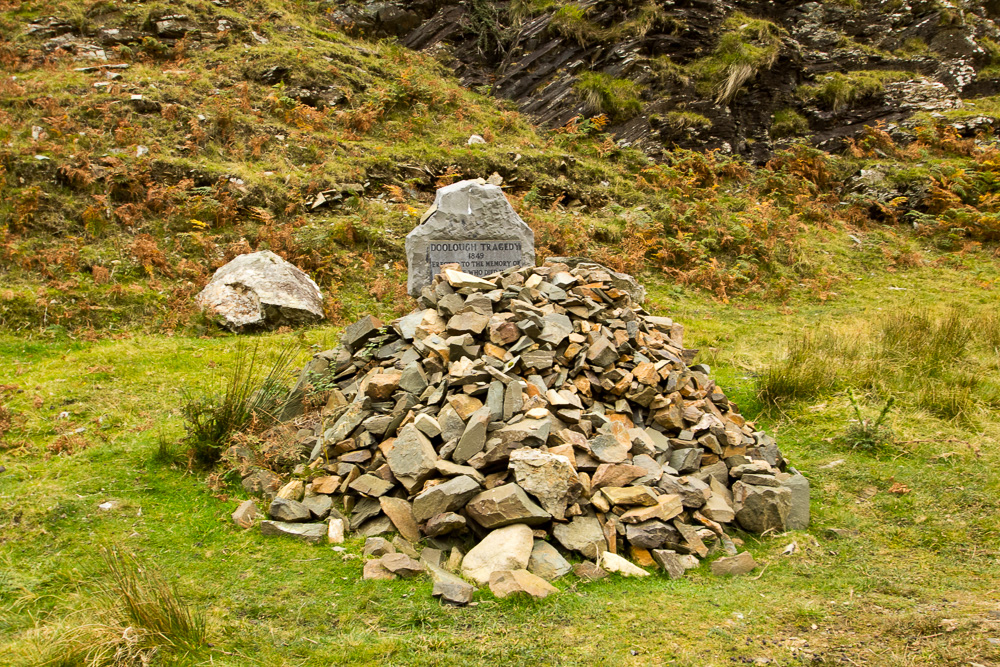
Doolough Memorial, 2015

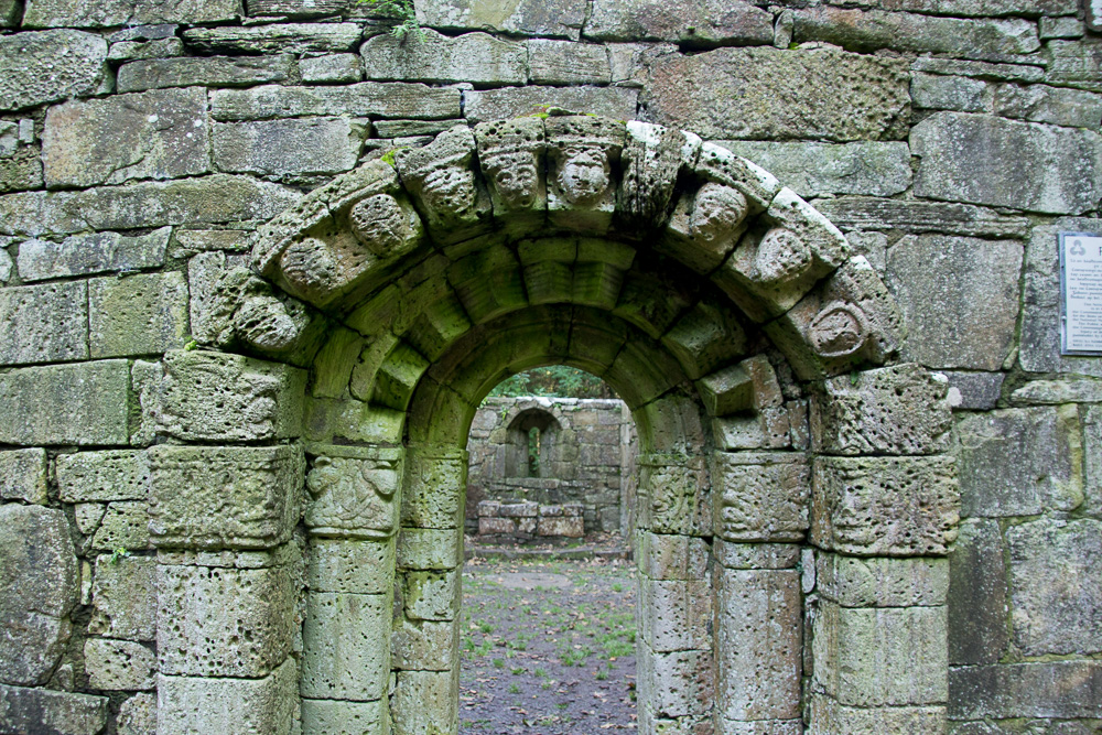
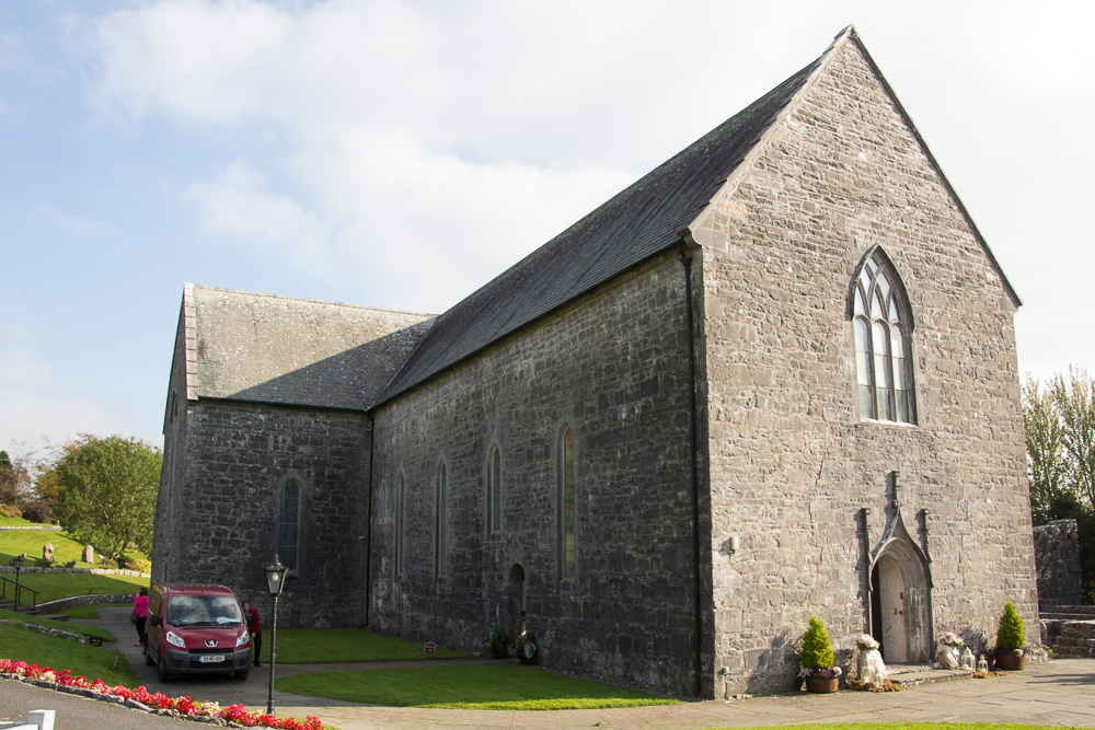
Ballintubber Abbey is located in eastern Mayo, east of Lough Mask and the towns of Tourmakeady and Finny. On my last blog, I mistakenly wrote that Ballintubber Abbey was in County Galway and I apologize for unintentionally locating this beautiful abbey in the neighboring county. If you wish to read about Ballintubber Abbey, return here.

20151002-FinnyMaskBtubber-2015050

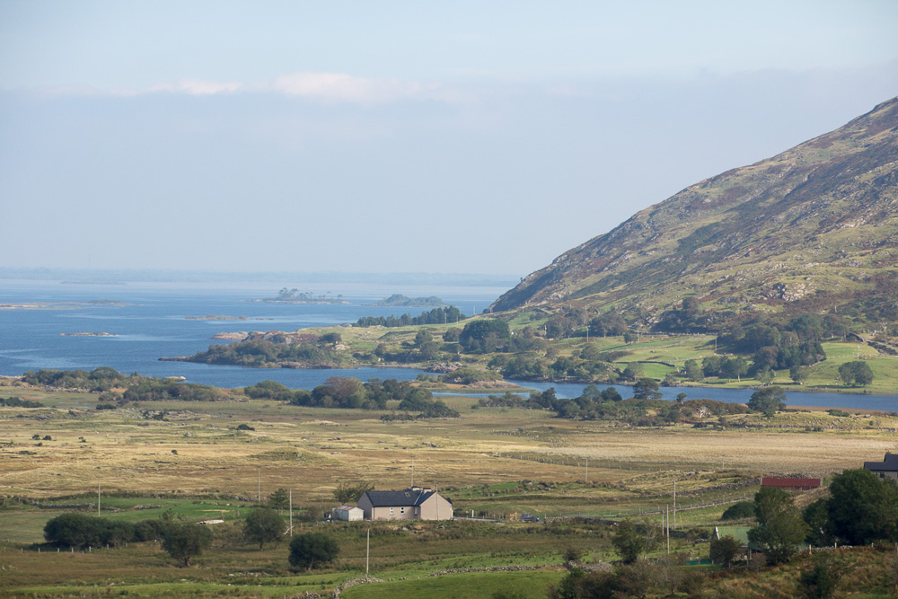
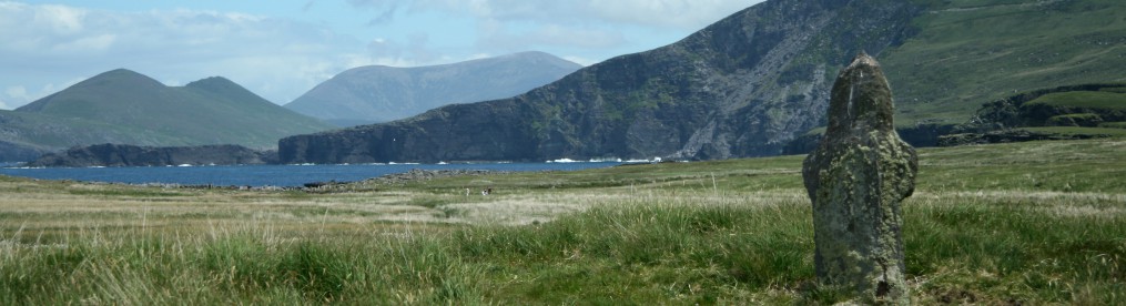
From the Lough Mask Drive near Tourmakeady

20151002-FinnyMaskBtubber-2015073

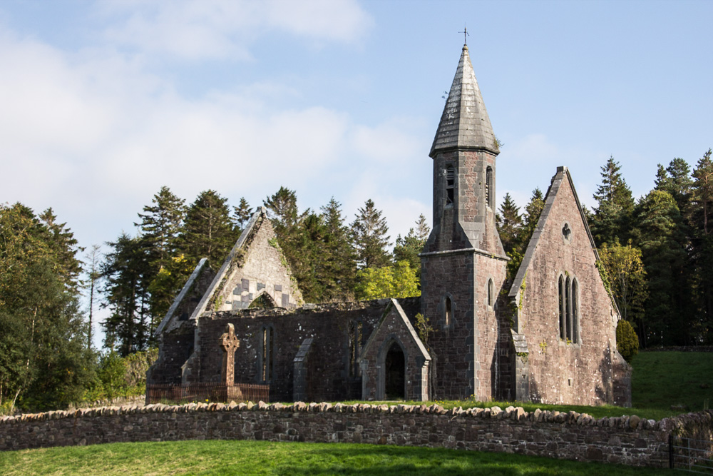
Tourmakeady Church of Ireland

20151002-FinnyMaskBtubber-2015080

Thomas Plunkett’s, Bishop of Tuam, Grave

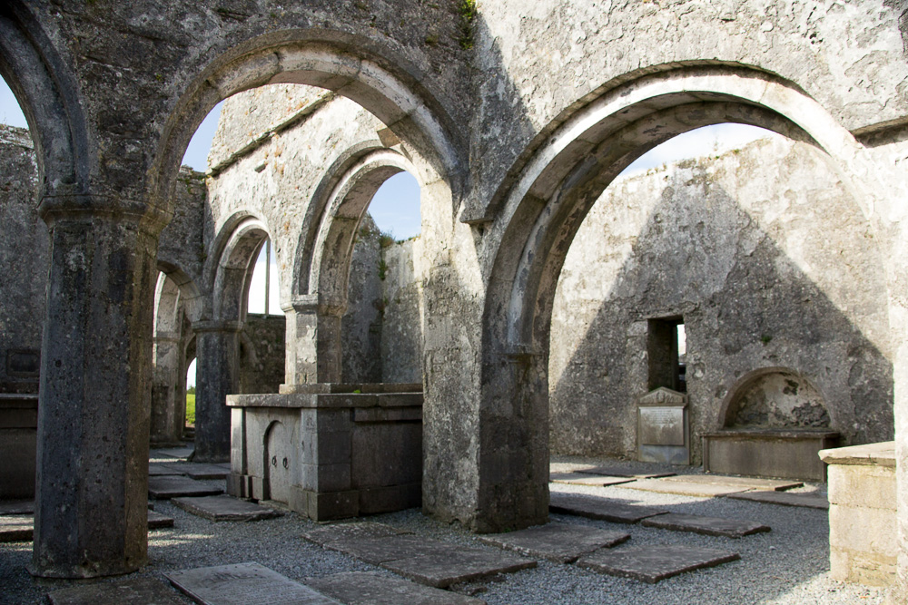
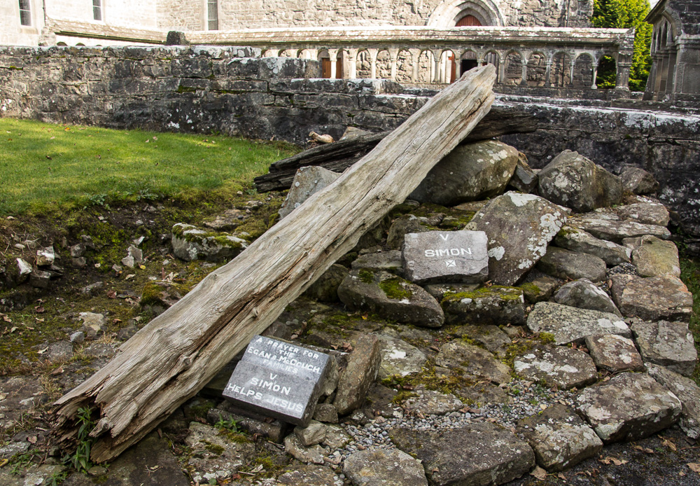
Most of the monastic and religious sites I’ve visited in Ireland are Roman Catholic, but at Tourmakeady, along the Lough Mask Drive, I found the beautiful ruins of a gothic Church of Ireland. While the grounds are lovely, including a large Celtic cross that marks the grave of Thomas Plunkett, Bishop of Tuam, the history of this area and Plunkett’s tenure here is odious. Click here for more information: http://www.mayo-ireland.ie/en/towns-villages/tourmakeady/tourmakeady-history.html, but to briefly summarize, 104 families were evicted from the area because they refused to send their children to Protestant schools in the 1860s.

20151005-FinnyMtnsLake-2015021

Lough Nafooey, near Finny, on a misty morning

20151009-ConnemaraGalway-2015034

On my last day in County Mayo, I made my final visit to the area near Finny, stopping at Lough Nafooey. Here, with my dearest friend, Kerry, I scattered the last of Jerry’s ashes. After singing The Parting Glass, I gently let him go, back to the place from whence his ancestors came, many years ago. As we left this place, this resting place, this thin place, I whispered to him a final Slán Abhaile.

IMG_3777

Photo Credit: Kerry Pannell

Click here to hear a beautiful version of this haunting song by Kate Purcell, with lyrics by Dermot Henry: https://www.youtube.com/watch?v=FfQLDZneFXQ

Slán Abhaile

The sun is down, the moon is blue
I think they know that I’m missing you
But time will heal this heartfelt pain
As soon as I see you again.          

            (Curfá)                                                            (Chorus)

Slán abhaile, slán go foil                               Safe home, good luck
Beidh mo chroi seo briste gan thú a stór     This heart of mine will be broken without                                                                                                you, my love
Nó go gcasfad arís orainn                              Until we meet again
Éist is bí ag smaoineamh                               Listen and be thinking
Ar an gceol ‘tá ag teacht                                On the music that is coming
Ó mo chroi seo amach                                   From the depths of my heart

I see an island, you’re on the pier
I see you crying in the misty air
You look so lonely, and there’s no one near
Wish I could hold you, wish you were here.

            (Curfá)

Look out your window when you’re feeling blue
You’ll see a bluebird looking in at you
Lay down your head, let yourself be free
Take in your deepest breath and sing with me.

(Curfá)

Ó mo chroi seo amach

Lyrics from: http://www.celticlyricscorner.net/ryan/slan.htm

IMG_1576

Jerry Finney May 23, 1947-August 14, 2013

Galway’s Splendor

20150929-Clonbur-2015444

Mountains of Connemara from Lough Corrib

County Galway, south of Mayo, stretches from the Atlantic Ocean, eastward to the Midlands, and has the greatest number of Gaeltacht areas, or Irish-speaking areas in the country. This is the home of Connemara, made famous by films such as the classic, “The Quiet Man,” with John Wayne and Maureen O’Hara, and “The Field,” starring Richard Harris and John Hurt.

IMG_0403

Aasleagh Falls, actually in Co Mayo, but on the border with Co Galway. A famous scene from “The Field” with Richard Harris was filmed here.

20150924-Clifden-2015026

Upper Sky Road, outside Clifden

I arrived in Clifden, on the coast, during the annual Arts Festival and the town was bustling with activity: concerts, readings, art walks. It was lively, and a little hard to find some thin places here, so I headed for the coast. The Sky Road is a fantastic, albeit narrow, little drive. There are actually two roads – the Upper and Lower Sky Roads, and this visit, I drove the Upper one and was fortunate to have sunny, clear skies.

From the Sky Road, I went north to Omey Island, a tidal island that is crossable at low tide from Claddaghduff Quay. As luck would have it, I arrived at low tide, but didn’t think it a good idea to drive my rental car across the sand, so I walked.

20150925-Clifden-2015026-2 20150925-Clifden-2015030-2 20150925-Clifden-2015022-2

Interestingly, there are signposts marking the way, just in case there was any question of where to cross. The island’s school closed in 1973, and no one is left now. It is yet one more place here in Ireland where time has stood still.

20150925-Clifden-2015051-2

Diamond Hill, Connemara National Park

The main entrance to the Connemara National Park is in Letterfrack, just a few kilometers northeast of Cleggan and Omey Island. Trees here are just beginning their autumnal transition, and the weather, while a little damp, was still mild enough for a nice walk up Diamond Hill. There are three loops of varying distance, and I wisely chose the shortest route since rain moved in just as I was coming back down the trail to the car park. Had the weather been better, I would have hiked higher up the mountain.

On my way back to Clifden, I saw a roadside holy shrine. Located near the Letterfrack Pier, the grotto is actively in use, as people were present when I first passed by, despite there not being parking available. This site is less accessible than most I’ve visited, and the precarious path to the top was steep and uneven.

20150925-Clifden-2015073 20150925-Clifden-2015078

Rosaries, statues, flowers, and other offerings were left at both the main shrine and the statue of Saint Patrick. I continue to marvel at the faith of people who come to these out-of-the-way places and I admire their devotion. A little bench under the trees provides a quiet place of refuge, despite the close proximity to the highway.

20150925-Clifden-2015085 20150925-Clifden-2015090 20150925-Clifden-2015098

Someone had recommended the small village of Cashel, in Connemara, to me. I drove south from Clifden on the R351 until I came to a local road that went due east. The R351 makes a loop from Clifden, down to Roundstone, and then back up again to Cashel, but the local road goes straight across a bog. Several loughs are here, with names like Lough Fada, Beaghcauneen, Cloonagat, and Conga, but there isn’t a way to access them because of the bogs. In the 30 minutes while on the local road, I only met two cars. There are no houses, no trees, and even the sheep are sparse here. This is a lonely place.

20150924-Clifden-2015049

Connemara Bogs above, and the Twelve Bens below

20150924-Clifden-2015048

The Twelve Bens (sometimes called the Twelve Pins), are the mountain peaks of Connemara. Ben is one of the Irish words for mountain; sliabh is another. Connemara is both mountainous and boggy, on the sea and on lakes. I think the light in Connemara is different from light anywhere else in Ireland, perhaps in part because of the presence of the Twelve Bens.

On the far eastern side of Connemara lie the towns of Cong and Clonbur. Cong, made famous by the John Wayne, Maureen O’Hara movie, The Quiet Man, is a little touristy but still has a nostalgic charm about it. Ashford Castle, originally built in 1228 and now a five-star hotel, is also here and some scenes from The Quiet Man were filmed on the Castle’s property. Cong is nestled here, where the River Cong flows into Lough Corrib, the largest lake in the Republic of Ireland.

20150929-Clonbur-2015189

Cong Abbey

20150929-Clonbur-2015208

20150929-Clonbur-2015498

Ashford Castle

Between the town and Ashford Castle, is Cong Abbey, and beyond it, Cong Woods. The forest’s deep mossy green is lush and thick, and the quiet is just as intense. I walk the path and nothing stirs. I see no animals, hear no birds. I am alone, surrounded by denseness: of woods, of air, of my thoughts. This is a place where one goes to walk and think.

20150929-Clonbur-2015243

20150929-Clonbur-2015272 20151001-CongWoods-2015027

20150929-Clonbur-2015375From Cong, I went by boat to Inchagoill, or Inis an Ghaill Crabhthigh: the Island of the devout foreigner, one of the 365 islands in Lough Corrib. Inhabited until 1946, Inchagoill is another place where time has seemingly stopped. Click here, for more information about Inchagoill.

Despite being among a large herd of tourists (which reminds me why I prefer to travel alone or in small groups), I wandered off to be alone among the ruins of two churches, one the Church of St. Patrick, c. 6th century,

20150929-Clonbur-2015395

Saint Patrick’s Temple

the other, the Temple of the Saints, c. 8th century. The forestry service has begun clearing some of the trails on the island, and while more convenient to traverse, I wonder how it will change the environment if more people visit this special place.

20150929-Clonbur-2015412

Temple of the Saints

20150929-Clonbur-2015409

East Galway is home to several monastic sites, and in addition to Cong Abbey, I visited the Ross Errilly Friary, near the town of Headford. Built in 1351, it is reputed to be the best preserved medieval site of its kind in Ireland and has National Monument status. I’ve visited many monastic sites but other than the Rock of Cashel in County Tipperary, this friary seems the most massive with intact cloisters, and numerous rooms, many covered with grave slabs.

20150929-Clonbur-2015324

Ross Errilly Friary

20150929-Clonbur-2015318

I think my favorite monastic site to date is Ballintubber Abbey seven miles south of Castlebar. The graveyard at Ballintubber marks the beginning of the Tóchar Phádrai, the ancient pilgrim pathway to Croagh Patrick. Built 800 years ago, the abbey itself is still in use today. I arrived just as a wedding ended. The abbey survived Cromwell’s attacks in 1653 and served Celebratory Mass for 785 continuous years. History just oozes out of this place!

20151002-FinnyMaskBtubber-2015166 20151002-FinnyMaskBtubber-2015089 20151002-FinnyMaskBtubber-201515920151002-FinnyMaskBtubber-2015094

After the wedding party departed, I meandered through the graveyard, ruins of the original abbey, and entered the church. The outdoor Stations of the Cross, however, were the most interesting aspect of Ballintubber, as the images of the Way of the Cross are constructed from native materials. I’m only including a few photographs of the images here, but I thought this an ingenious use of local stone and wood in this special holy place.

20151002-FinnyMaskBtubber-2015098 20151002-FinnyMaskBtubber-2015100 20151002-FinnyMaskBtubber-2015115

To close on a personal note, I spent a week outside of Clonbur at this adorable little cottage, complete with half door, stone walls and floors, and thatched roof.

20150927-Clonbur-2015056 20150928-Clonbur-2015090

It was an absolutely perfect place, in part, because it was just up the road from the village of Finny, which is actually in County Mayo, but that we believed was the area from where Jerry’s ancestors came. Daily, I went to a little spot near the cottage where two parts of Lough Mask joined on the Galway side. This was, in a non-mystical way, a thin place, for it called me to come every day to see the water, the sky, the mountains. With one exception, this spot was always deserted when I visited. This was my place, my personal thin place, in County Galway.

20150928-Clonbur-2015100 20150928-Clonbur-2015109 20150930-Clonbur2-2015023

I’ll miss you, Gaillimh, but I’ll be back one day.

Feeling my Fear on Achill Island

IMG_0273

I have fallen in love with Achill Island, Ireland’s largest island (of an island?), but connected by a bridge at Achill Sound. Achill is a popular summer resort area, but it was quiet in September. I checked into the Bervie Guesthouse and I only mention it specifically by name because it was just listed as “Hideaway of the Year” in the Irish Georgina Campbell Awards.

20150922-AchillIsland-2015036It is located directly on Keel Beach, and the third-generation owners, Liz and John Barrett, are some of the kindest people I’ve ever met.

My first day, I arrived on a blustery, gray day and after a quick soup and brown bread at the Beehive, decided to go to Keem Beach, located on the western side of Achill.

20150921-AchillIsland-2015001

However, as I drove the narrow mountain road, with the ocean directly on my left (and no barrier on the side!), and both the sea and cumulus clouds threatening me, I chickened out. I pulled into a little place on the right side of the road and cautiously turned around and headed back down to the safety of my B&B. Why do I tell you this? Because the next day, my perspective about fear was forever changed.

20150921-AchillIsland-2015033

The storm had passed and the morning sky was sunny and clear. After breakfast, I talked with Liz and John and asked directions to Keem Beach, and wondered if there was another way to get there. They told me I had been on the correct road, and no, there was no other route. I explained I had become unexpectedly anxious the day before and turned around before I reached the summit. Liz then said the most profound thing to me.

Feel your fear, then go on through it, and do what you need to do.

As I drove, I let that sink in. Feel your fear. Acknowledge it. Don’t act like it doesn’t exist, but then, GO ON THROUGH IT. Don’t let it hold you back from doing what you need or want to do. I remembered the last three years and realized that is what I had been doing. When we received the diagnosis, and then through treatments and later hospice, and then after my husband died, that’s what I did. I was afraid during all of those times, and I completely felt that fear. But I didn’t stop. I kept on going through the fear, despite the fear.

20150922-AchillIsland-2015055

I drove up the mountain and saw the spot where I’d turned back, but this time, I kept going. As I came over the crest of the mountain, there below me, was Keem Beach, in all of her magnificent beauty. I found a place to stop on the side of the mountain, hopped out of the car, and just soaked in the view.

20150922-AchillIsland-2015085 20150922-AchillIsland-2015079

I went down closer to the shore and basked in the sunshine for over an hour, frequently gazing up the mountain at the road I had just traveled and feeling both proud of myself, and grateful for Liz’s kind wisdom.

From Keem, I drove back to the center of the island and visited the Deserted Village at Slievemore. Years ago, Jerry and I had tried to visit the Village, but it was pouring rain and the road was washed out. We had to turn around on the narrow little road, with me out of the car in the rain, giving directions. It was not the best of times. However, on this day, the sun was shining, and as I pulled into the car park, I saw the sign that somehow, we had missed the last time: No Through Road.

20150922-AchillIsland-2015114

I walked the ruins of many of these 80-100 stone buildings that stretch for approximately a mile. It is believed that some of the buildings were used even into the early 20th century as “booleys,” or temporary housing during the summer when people would bring their cattle to graze these pastures. As I walked this generally sheltered, but rough terrain, I contemplated the people who had lived and worked here. Rugged land requires rugged people, and those who settled here must have been incredibly strong of body, mind, and spirit. Why did they choose this location to settle, and when and why did they leave?

20150922-AchillIsland-2015119 20150922-AchillIsland-2015134 20150922-AchillIsland-2015127 20150922-AchillIsland-2015139

20150923-AchillIsland-2015208Sean Relig Chill Damhnait, or the old graveyard at Kildavnit lies on a peninsula south of Achill Sound. Walking among the gravestones and burial plots, some dedicated to victims of An Gorta Mor or victims of a fire or shipwreck, the realm of the spirit world is palpable. A mountain stands in the background, as the graveyard gently slopes down to the water. Across the road, a newer cemetery is built, but this place, this ground, is home to generations of ancestors. This was a thin place.

20150923-AchillIsland-2015229
20150923-AchillIsland-2015238
20150923-AchillIsland-2015226
20150923-AchillIsland-201523420150923-AchillIsland-2015220

The stone plaque on the remains of the old church explains that Damhnait or Davnet, was a seventh century Irish saint who probably built a church here, after she fled pursuers. Later, according to tradition, Grainuile (Grace O’Malley, the Pirate Queen) built a church here in the 16th century to “facilitate worshippers from her nearby castle.” Read here for more about Grainuile and her castle at Kildavnit: http://www.achilltourism.com/granuaile.html

IMG_0291

IMG_0295

Achill Island, you touched me in a special way at this time in my life. As the setting sun painted the land and sky in the same colors as your heather, fuschia and Monbretia, I breathed in the words, “I have arrived. I am home.” I am here, at this moment, and I am at peace.
20150922-AchillIsland-2015191


20150922-AchillIsland-2015178

Wild, Wild Erris

20150919-Belmullet-2015010

Of the four regions of Ireland, Connaught is probably the most rugged. Stretching along the west of Ireland, the landscape of Counties Mayo and Galway, alternately mountainous and boggy, is frequently shrouded in a deep mist which the sun does not easily pierce. But when it does, the sky is a brilliant blue and the land has a golden hue.

20150921-Belmullet-2015124

The bogs stretch for miles and little of substance grows here. With increasing pressure from the EU, turf or peat harvesting is in substantial decline, and the bogs are continuing their centuries-old cycle of growth and decay, growth and decay. Sheep graze on the mountains and hills, but there are few cattle. Fishing the Atlantic waters continues and is a dangerous occupation. The week I was here, searches were ongoing for a local man who was missing at sea. As one man in a pub told me, “the sea is a harsh mistress.”

20150921-AchillIsland-2015029

Some describe the area of Erris and the Belmullet Peninsula in northern Mayo as the “last frontier,” and it appears to be so. While Donegal to the north is also rugged with mountains, this area is different. The wind blows constantly across the treeless bogs and rocky outcroppings. Even in September, the gales from the Atlantic are relentless. It takes strong people, familiar with the land and sea, to live here. This is an area of the Gaeltacht, where all of the road signage is in Irish and outsiders are noticed. It is a place where the intensity of nature has taken its toll on the land and its inhabitants. It is Mayo.

20150919-Belmullet-2015002West of Belmullet, on a coastal road, is Dun na mBo, Fort of the Cow. This iron and stone structure stands silent watch over the ocean below, and entering between the slanted columns and protected by a strong gate, I see the maelstrom. Dun na mBo jarringly reminds you that you are a guest of nature here. You learn to respect and fear the sea or she will consume you.

20150919-Belmullet-201502820150919-Belmullet-2015024

20150920-Belmullet-2015069Blacksod and her stalwart lighthouse are at the end of the Belmullet Peninsula. On the day I drove to her, fog and rain surrounded Blacksod, and I didn’t venture far from my car. I wished the weather had been more accommodating, as I wanted more suitable photos of the sculpture in the shape of a boat near the pier. Each pillar symbolizes a different ship that emigrants boarded leaving from Blacksod, and on each stone is a plaque bearing the known names of those who departed. The website, http://www.blacksodbayemigration.ie/ explains the memorial:

“A memorial garden has been created in Blacksod by Comharchumann Forbartha Ionad Deirbhile Eachléim in 2013 marking the 130th anniversary of the first sailing. The orientation of the boat is due west indicating the direction of the emigrants’ journey across the Atlantic. The side of the boat is divided into fifteen sections, each representing a ship that left Blacksod Bay. The width of each section relates to the number of passengers who left on each ship and their names are displayed. The sections are separated by spaces of varying sizes representing a timeline of their departures.”

20150920-Belmullet-2015073

Blacksod is a place of emigration. It is a place of memory.

As I left Erris, I drove along Broadhaven Bay before heading south for towns with names like Ballycroy and Mallaranny. I will let the photos speak for themselves.

20150921-Belmullet-2015085 20150921-Belmullet-201510620150921-Belmullet-201509920150921-Belmullet-201510420150921-Belmullet-2015077